Local Walks
Click on the image to get full map.
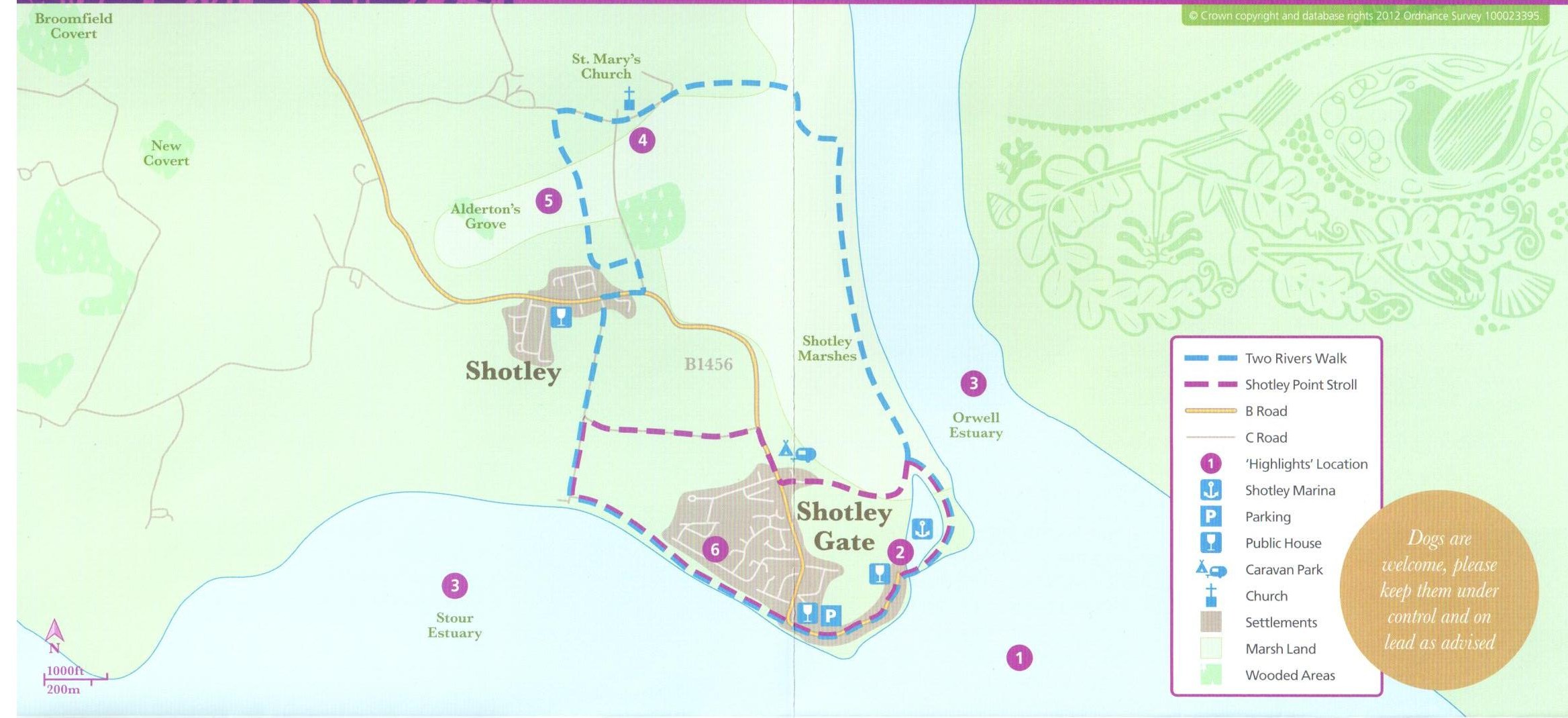
Shotley Stroll Distance 3.1 miles(5km)
Terrain: Paths and tracks can be muddy after rain. Cattle are often grazing on the marshes, so please keep dogs on leads. Some Sections are near deep water. These walks take you onto public highways. We recommend high visibility clothing.
Stand by the marina Control Tower. Walk to your left crossing the lock gates, either the inner or outer gates as both have walkways across. Continue around the seaward side of the marina.
Turn left at next path junction and follow path behind marina. Take next right and continue beside fence to road. Cross road and turn right. At end of row of houses, take track left. At cross tracks, besides Shotley Cottage, turn left towards river. When you reach houses turn left. Follow path beside gardens, along field edge. Either take a right turn, at coastal footpath sign and continue past the pub along the roadway back to the marina and the Shipwreck Pub and restaurant. Or, walk past ‘Coastal Path’marker up the hill into the woodland. Follow upper woodland path through the Heritage Park. Emerge from the woodland, turn right into Estuary Road. Continue down to main road and turn right to the river, then turn left at the bottom and walk along the seawall back to the marina and the Shipwreck Pub and restaurant for a welcome refreshment.
Two Rivers Walk Distance 5.3 miles (8.5km)
Time: 2 hours 30 mins
Stand beside the Control Tower, cross the lock by either the inner or outer gates as both have walkways across them. Continue around the seaward side of the marina. Turn right along river wall at path junction. Follow wall for some distance (ignore path to left and steps near sluice). Keep straight ahead for 200 metres.
Go left at the ‘footpath’ sign down seawall, through gate and along edge of field. Ignore path to right and continue through next field to gate in top right hand corner. Follow track. Turn left at ‘Cycle Route B’ sign. Pass Shotley Church and continue straight at crossroads.
Opposite Shotley Hall, take path left. Follow path through trees across footbridge and along field edge. At houses turn left along path to road. Turn right and follow road to junction with main road. Turn right until opposite Rose Farm.
Cross road and take ‘Restricted Byway to right of farm. At cross tracks beside Shotley Cottage, continue straight towards the River Stour.
When you reach houses turn left. Follow footpath beside gardens, along field edge. Either take a right turn, at coastal footpath sign and continue to the public house by the corner of Bristol Hill, and continue along path back to the marina and the Shipwreck for a well earned drink!
Or, walk past ‘Coastal Path’ marker up the hill into the woodland. Follow upper woodland path through Heritage Park. Emerge from woodland, turn right into Estuary Road. Continue down to main road, turn right down the hill to the bottom of the hill, turn left and return along path and seawall to the marina.